 Hyperlocal Weather
Exactly how much rain fell at your location
Hyperlocal Weather's rain gauge shows measured rain totals for the last 12 hours, 24h, 48h, 72h, 7 days and year to date — plus a calendar of every wet day and an accumulation map. No physical gauge, no guesswork. On iPhone & Android, worldwide.
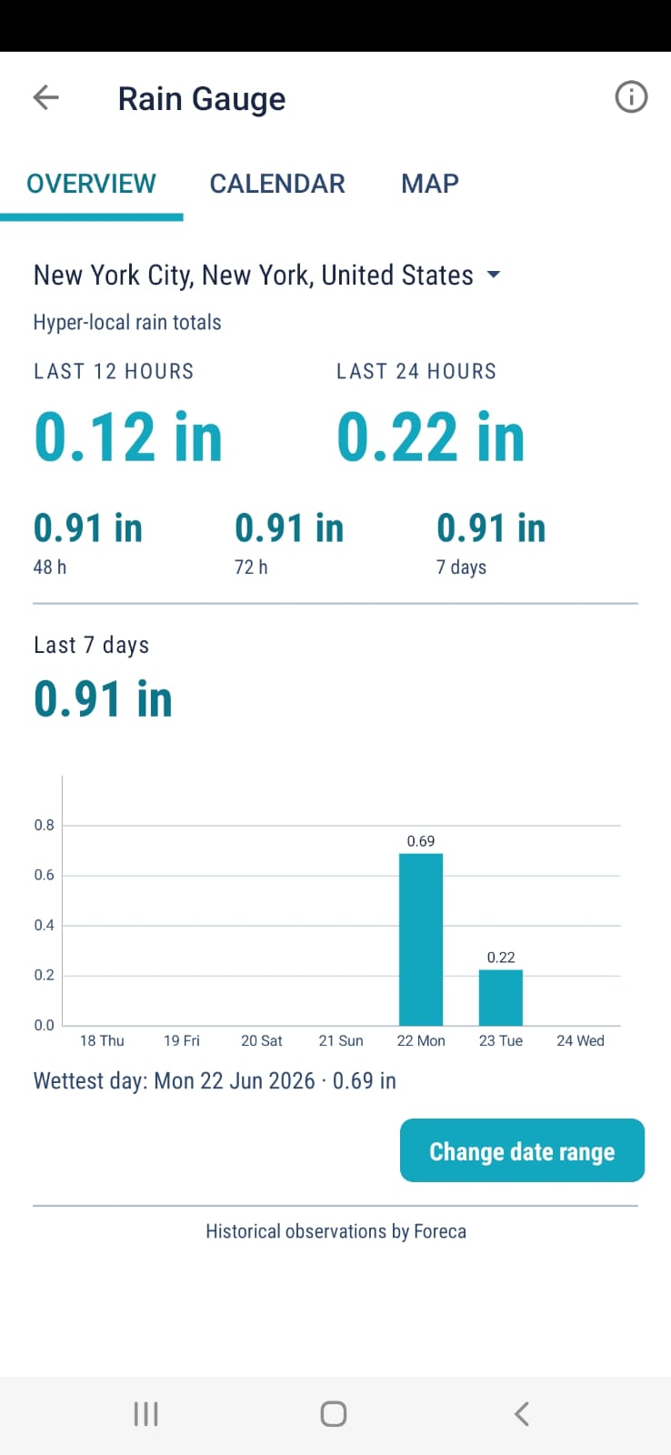
Rainfall accumulation, at a glance
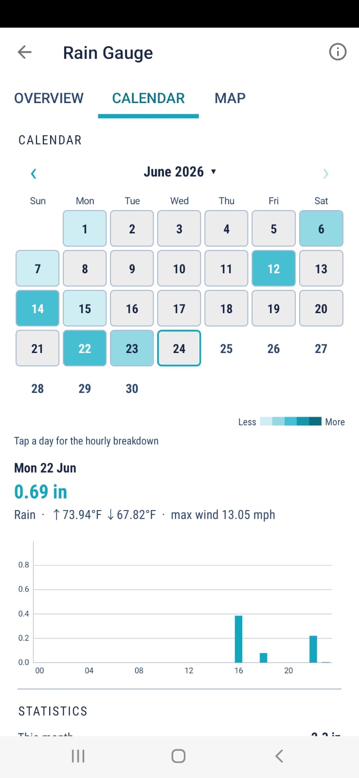
A calendar of every wet day
See a month at a time as a rainfall heatmap — darker days mean more rain. Tap any day for its total and an hour-by-hour breakdown, and scroll back through your rainfall history.
- Daily totals with an hourly breakdown per day.
- Month heatmap — spot dry spells and wet stretches instantly.
- Look back over past days, weeks and months.
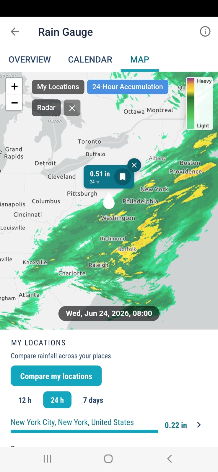
See the rain on the map
A precipitation-accumulation map shows how much rain has fallen across the region over the last 24 hours — so you can see whether the storm hit your side of town or missed it.
- 24-hour accumulation mapped to your area.
- Pinpoint totals for your exact coordinates.
- Zoomable from your street to the whole region.
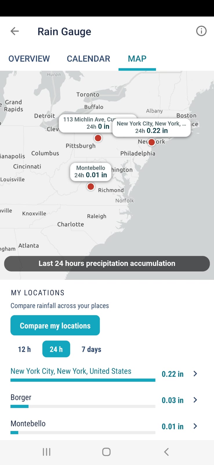
Compare rainfall across your places
Save home, the cabin, the farm or the job site and compare how much rain each one got over 12 hours, 24 hours or 7 days — side by side.
- All your locations ranked by rainfall.
- 12h / 24h / 7-day comparison windows.
- Perfect for gardeners, farmers and contractors.
Rain totals that work in your country
Most rain totals apps only work in the United States. Hyperlocal Weather measures rainfall worldwide and runs on both iPhone and Android — so you get the same hyper-local history wherever you are.
What are rain totals?
A rain total (or rainfall total) is the amount of precipitation that has accumulated at a location over a period of time — usually measured in millimetres or inches. Traditionally you needed a physical rain gauge in your garden to measure it. Hyperlocal Weather gives you a virtual rain gauge instead: it estimates the rainfall at your exact coordinates from high-resolution radar, real weather-station observations and forecast models, so you can see how much rain fell without any hardware.
How Hyperlocal Weather measures rainfall
Rather than reading a total from a distant airport station, Hyperlocal Weather pinpoints your location and blends multiple data sources — including Foreca and Apple WeatherKit — to produce accurate, hyper-local rain totals. The same engine powers the next-hour rain forecast, so you get both the rain that has fallen and the rain that's about to.
Who uses rain totals?
- Gardeners deciding whether the garden still needs watering.
- Farmers and growers tracking rainfall across fields.
- Contractors and landscapers checking if the ground is too wet to work.
- Anyone curious how much rain that storm actually dropped.
Looking for the live picture instead? Explore the rainfall radar, the full rain gauge app, or how our rain drop gauge compares.
Rain totals questions
How do I see how much rain I got?
Open Hyperlocal Weather's rain gauge to see rain totals for your exact location — the last 12 hours, 24h, 48h, 72h, 7 days and year to date. Each figure is the measured precipitation accumulation at your spot, so you know exactly how much rain fell without a physical rain gauge.
Does Hyperlocal Weather show historical rainfall totals?
Yes. A calendar heatmap shows every wet day with its daily total and an hourly breakdown, so you can look back over past days, weeks and months of rainfall history — on both iPhone and Android.
Do rain totals work outside the United States?
Yes. Unlike US-only rain totals apps, Hyperlocal Weather works worldwide — including the UK, Ireland, Canada, France, Germany, Austria, Switzerland, the Netherlands, the Nordics, Japan, Singapore and Australia.
How accurate are the rain totals?
Rain totals combine high-resolution radar, real weather-station observations and forecast data from Foreca and Apple WeatherKit, pinpointed to your exact coordinates rather than a distant airport.
Related rain tools
See how much rain you got
Get Hyperlocal Weather and track rain totals for your exact location — iPhone, Android and worldwide.